St Ives - Sea View Terrace - Photo of Second World War - Cornwall England
Published on January 18, 2019
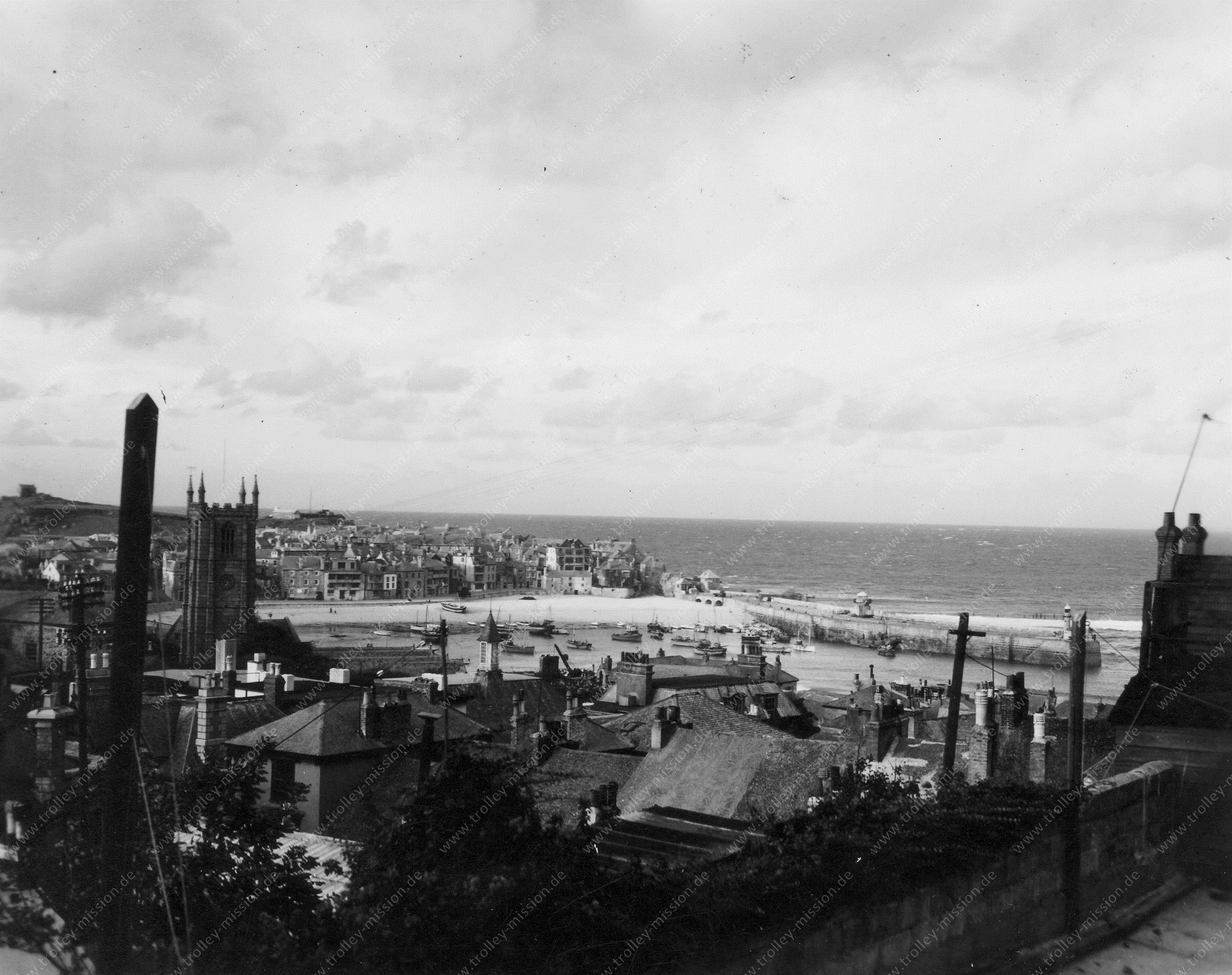
This photo was taken by unknown pilots (392. Bomb Group) in 1945. St Ives is a seaside town and port in Cornwall, England. The town lies north of Penzance and west of Camborne on the coast of the Celtic Sea. In former times St Ives was commercially dependent on fishing. Today the town is primarily a popular seaside resort.
Luftwaffe Airfield Gütersloh - Air Photo World War II
Published on January 14, 2019
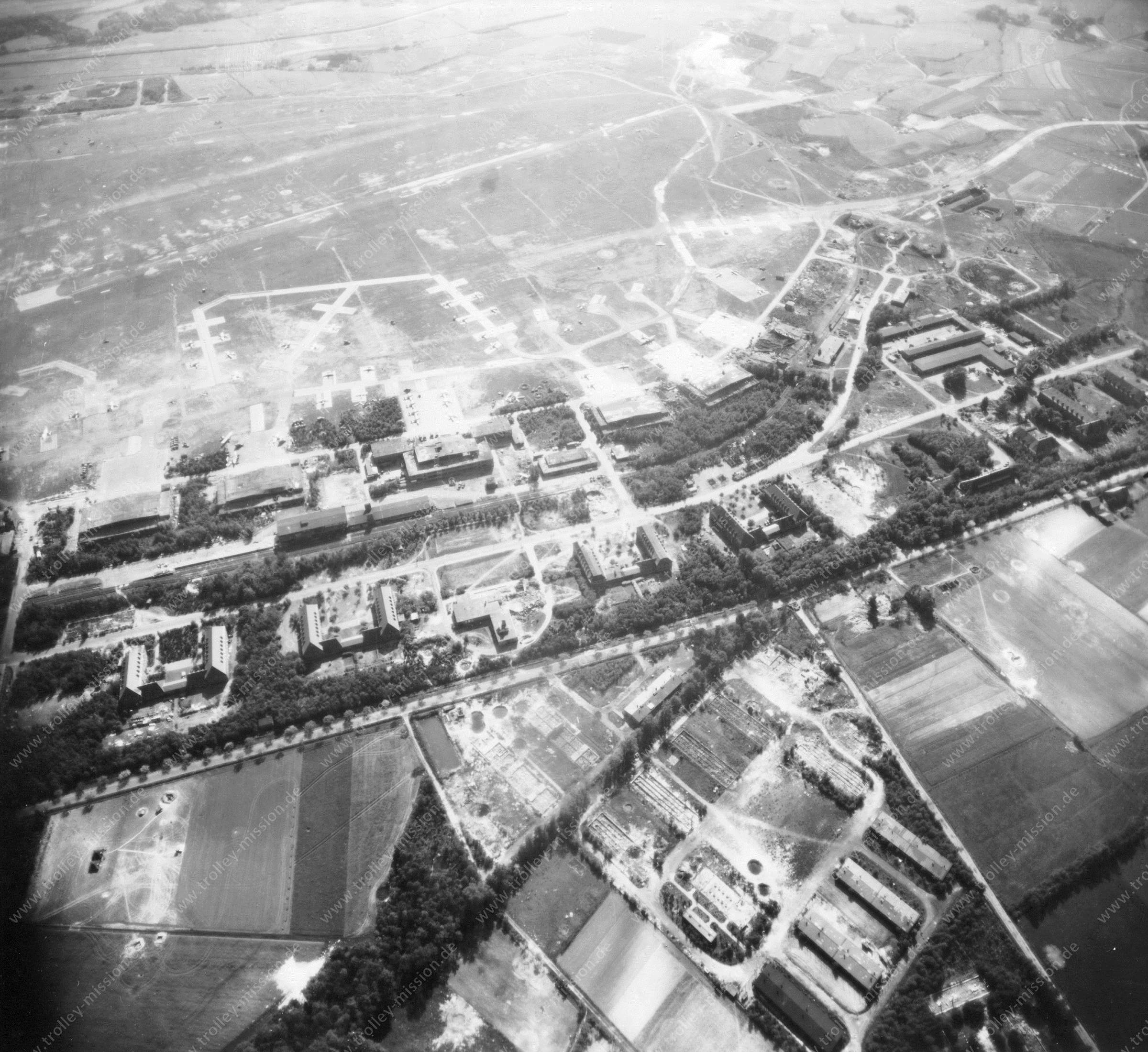
Probably the construction of Airfield Gütersloh began in 1935. The German Army and the German Air Force (Luftwaffe) were based on this airport. For example, there were based Ju 88 Nightfighters (Nachtjagdgeschwader). The airfield was captured by the US Army in April 1945 and designated as Advanced Landing Ground Y-99. Later the airfield was handed over to the Royal Air Force (RAF). On 30 June 1993, RAF transferred the airfield to the British Army. The air base became a British Army Garrison, called the Princess Royal Barracks, Gütersloh, a base for British Army helicopters, and Royal Logistic Corps Regiments.
Fassberg Air Base - Air Photo World War II
Published on January 14, 2019
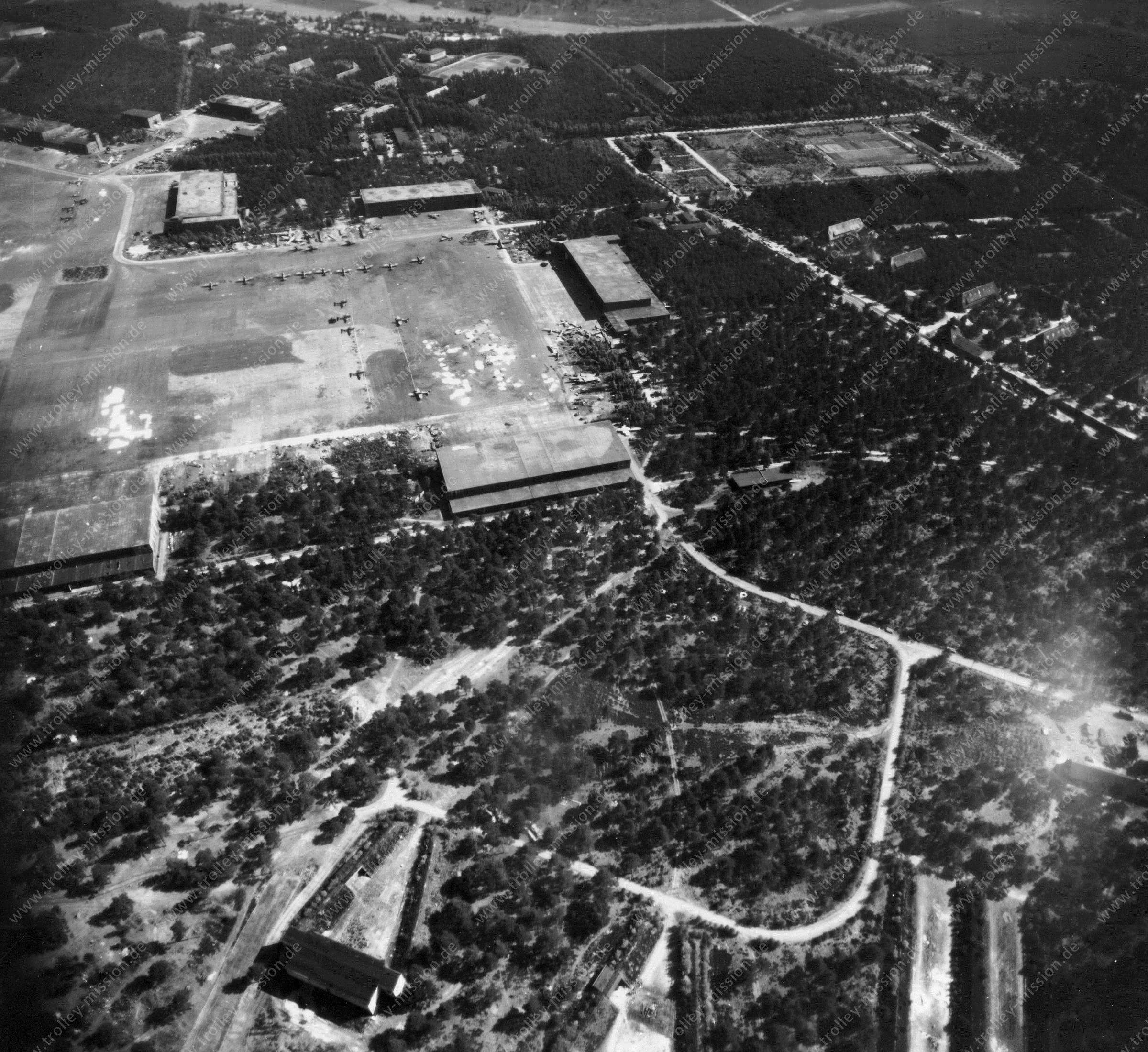
This airfield was established in 1934. Between 1934 and 1945 the German Army and the German Air Force (Luftwaffe) were based on the air base. There were flying aircraft, for example, Junkers Ju 52, Junkers Ju 88, Heinkel He 111, and towards the final stages of World War II Messerschmitt Me 163 and Messerschmitt Me 262. In April 1945 the airfield was overrun by the British Army and subsequently used by the Royal Air Force. It was renamed first Airfield B 152 and later RAF Fassberg. During the Berlin Blockade RAF Fassberg played an important role as a hub for supplying the city. There aerial photo was taken on May 12, 1945. Today, the Fassberg Air Base is used by the German Army Aviation Corps.
Aerial Photo of Wendling Airfield - Royal Air Force Station Wendling or RAF Wendling
Published on January 14, 2019
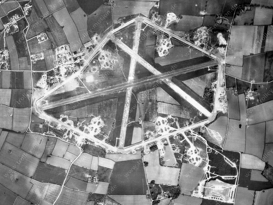
The Wendling Airfield was opened in 1942, and it was used by both the Royal Air Force (RAF) and United States Army Air Forces (USAAF). During the war it was used primarily as a bomber airfield, being the home of the United States Army Air Forces Eighth Air Force 392nd Bombardment Group. Royal Air Force Station Wendling or RAF Wendling was located 4 miles north west of East Dereham, Norfolk, England. The airfield was finally closed in 1961 and returned to agriculture.
Aerial view of Dover Harbour May 1945
Published on January 14, 2019
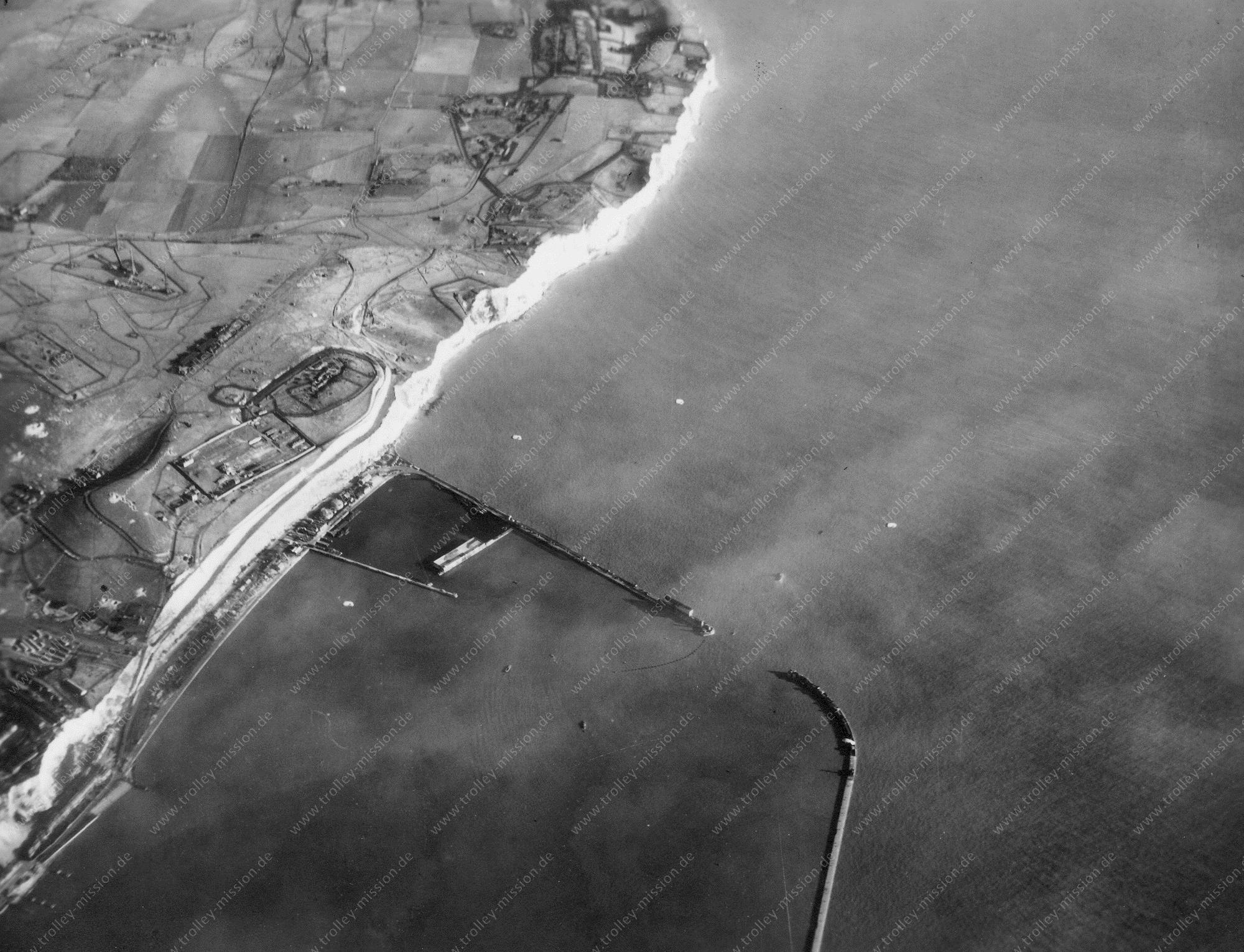
Dover is a major ferry port in Kent, South East England. It faces France across the Strait of Dover, the narrowest part of the English Channel. During the Trolley Mission, the Port of Dover was a waypoint for air navigation.
Great Yarmouth - Aerial Photograph May 1945 - Airborne Imagery 2/2
Published on January 14, 2019
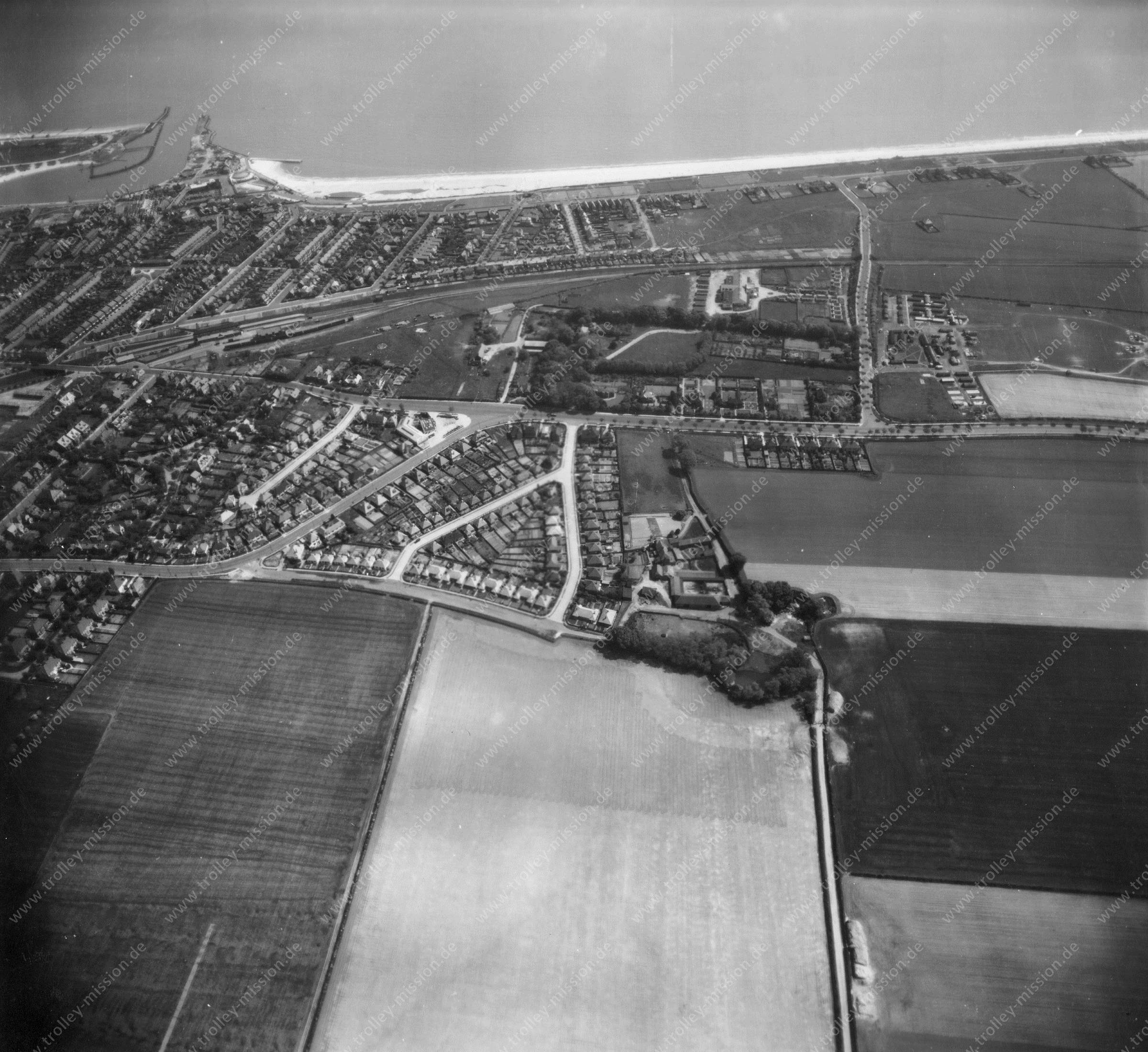
Great Yarmouth, often known to locals as Yarmouth, is a seaside town in Norfolk, England. It is located at the mouth of the River Yare, approximately 20 miles east of Norwich. This aerial photograph was taken during the Trolley Mission on May 12, 1945. The pilots of the Trolley Mission started at Wendling Airfield. To fly to Germany, they had to cross the English Channel. Great Yarmouth was the last chance for an emergency landing, so the seaside town was photographed several times.
Great Yarmouth - Aerial Photograph May 1945 - Airborne Imagery 1/2
Published on January 14, 2019
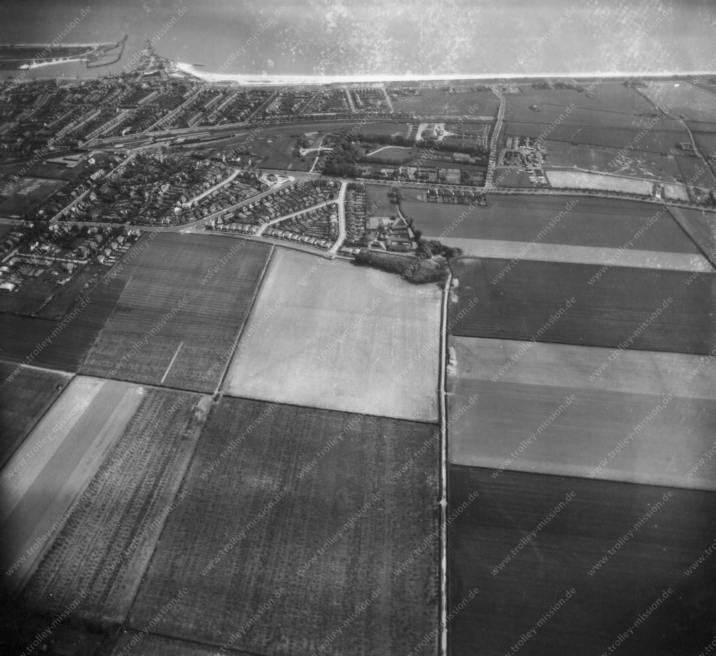
This aerial photograph was taken during the Trolley Mission on May 12, 1945. Great Yarmouth, often known to locals as Yarmouth, is a seaside town in Norfolk, England. It is located at the mouth of the River Yare, approximately 20 miles east of Norwich. The pilots of the Trolley Mission started at Wendling Airfield. To fly to Germany, they had to cross the English Channel. Great Yarmouth was the last chance for an emergency landing, so the seaside town was photographed several times.
Bridge at Remagen - Aerial Photo of the Ludendorff Bridge over the Rhine (Battle of Remagen)
Published on January 14, 2019
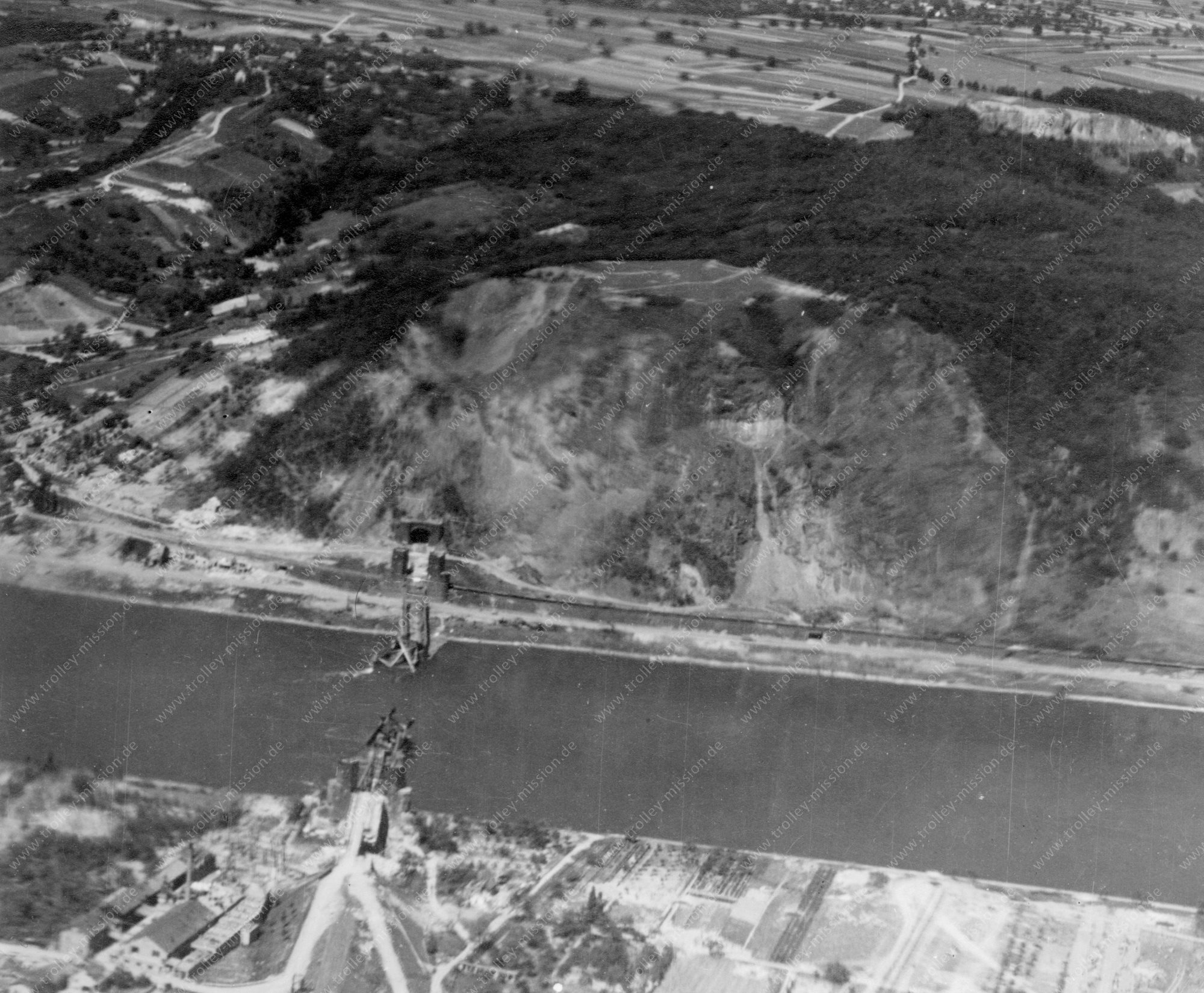
The Ludendorff Bridge, also known as the Bridge at Remagen, was in early March 1945 one of two remaining bridges across the river Rhine in Germany when it was captured during the Battle of Remagen by United States Army forces during the closing weeks of World War II. Built in World War I, the bridge connected Remagen on the west bank and the village of Erpel on the eastern side between two hills flanking the river. On March 7, 1945, the troops of the U.S. Army approached Remagen and were surprised to find that the bridge was still standing. After the U.S. forces captured the bridge, German forces tried to destroy it multiple times. Finally, the bridge collapsed on March 17, ten days after it was captured. The bridge that played the most important part in the final subjection of Germany was the Remagen bridge.